Archives

Sunday, November 30, 2008

Kyocera Phantom KE413

Say hello to your new comrade in communication the Kyocera Phantom KE413. Here's what being told about optional user changeable mask to match your cell phone to your mood, or your mood to your cell phone optional sport clip to attach your phone to your backpack or purse text messaging with funky animation download able screensavers and built in polyphonic rings.

Features
  • Product Line : Phantom
  • Cell Network Technology : CDMA
  • Talk Time : 3.5 hrs.
  • Standby Time : 7.5 days
  • Additional Features : E-911 Compliant
  • Antenna Style : External
  • Vibrating Alert : Yes
Display
  • Display Type : LCD
  • Display Color Support : Monochrome
Power Managment
  • Battery Technology : Lithium Ion
General Product Info
  • Height : 4.4 in
  • Width : 1.9 in
  • Depth : 0.9 in
  • Weight : 3.5 oz
  • Also known as : Kyocera Phantom, Kyocera KE413
  • Manufacturer Part No. : KE413
  • Dimension : 4.4 in x 1.9 in x 0.9 in(HxWxD)
Read More >>

Kyocera Rave KE433

Make this phone your own. Simply change the faceplate to a color that matches your mood or download a crazy ring tone.

Add to that the built in flashlight option, a customizable splash screen and contact cartoon call alert for incoming calls, and you've got yourself a phone that knows what's up. A scheduler, calculator and alarm clock help keep that world of yours comfy and in control.

Features
  • Product Line : Rave
  • Cell Network Technology : CDMA
  • Talk Time : 3.5 hrs.
  • Standby Time : 7.5 days
  • Connector Types : Headset jack, Data port
  • Messaging : EMS
  • Additional Features : Animation For Incoming Call, Tty Compatible, Intelligent Typing (Ezitext), E-911 Compliant
  • Antenna Style : External
  • Installed Games : Tetris, Brick Attack, Doodler
  • Network Technology : CDMA2000 1X 1900/800
  • Phone Book Capacity : 200 Names & Numbers
  • Voice Dialing : Yes
  • Vibrating Alert : Yes
Display
  • Display Features : Wallpaper, Backlit
  • Display Type : LCD
  • Display Color Support : Monochrome
  • Display Capacity (Lines) : 5
Power Managment
  • Battery Technology : Lithium Ion
General Product Info
  • Height : 4.4 in.
  • Width : 1.9 in.
  • Depth : 0.9 in.
  • Weight : 3.5 oz.
  • Also known as : Kyocera KE433, Kyocera Rave
  • Manufacturer Part No. : KE433
  • Dimension : 4.4 in. x 1.9 in. x 0.9 in.(HxWxD)
Read More >>

Kyocera K323

In this ubiquitous network age, globalization and speed mean everything. Kyocera continues to create "valuable businesses" at the cutting edge. Kyocera is concentrating its efforts on enhancing information and communications technologies, environmental preservation, and the quality of life.

Product Features
Internal antenna and silky, smooth soft feel finish add to its premium appeal. Bluetooth wireless technology. VGA camera for capturing family moments, which can be stored on phone or sent to friends.

Easy to use keypad with direct access to volume control and speakerphone. Large, vivid, internal color display to take it all in. Color picture caller ID to see who's calling.

Full featured camera with dedicated camera button, multi shot adjustment, auto focus, self timer, resolution adjustment, white balance, color effects adjustment and fun frames.

Built in MIDI and MP3 ring tones, screen savers and caller alerts. SMS or EMS, MMS and instant messaging. Predictive text input software for rapid text entry.

Voice activated dialing. Vibrate alert. Secure battery with patent pending technology. Photo phone book to store up to 500 contacts. Scheduler, alarm clock, stopwatch, countdown timer, calculator, tip calculator, and voice memos. Web access and the ability to send and receive email.
Read More >>

Sony Ericsson W950i

The W950i Walkman is a slim and stylish mobile phone with an advanced digital music player and large touchscreen for optimal ease of use. Using the W950i is easy.

The keypad of the slim W950i is smooth and flush with the surface, and the dedicated music player keys and other controls have one press to open functionality. Download hit songs to your W950i wherever you

Features
  • Cell Phone Type : Digital Player, FM Radio, MP3
  • Cell Network Technology : WCDMA, GSM
  • Wireless Technology : Infrared, Bluetooth
  • Talk Time : 7.3 hrs.
  • Standby Time : 14.2 days
  • Operating System : Symbian OS
  • Supported Media Format : AAC, MP3
  • Key Functions : Digital Player, Radio
  • Connector Types : Data port, IrDA
  • Messaging : MMS
  • Additional Features : Radio Data Service (Rds)
  • Antenna Style : Integrated
  • Colors : Mystic Purple
  • Included Functions : digital player / FM radio
  • Network Technology : WCDMA (UMTS), GSM 900/1800/1900
  • Vibrating Alert : Yes
Display
  • Display Features : LCD touch screen, Wallpaper, Screensaver
  • Display Type : LCD
  • Display Resolution : 240 x 320 Pixels
  • Display Color(s) : White
  • Display Color Support : Color
General Product Info
  • Height : 4.2 in.
  • Width : 2.1 in.
  • Depth : 0.6 in.
  • Weight : 4 oz.
  • Also known as : Sony Ericsson Mobile Communications W950I, Sony Ericsson
  • Manufacturer Part No. : W950I
  • Dimension : 4.2 in. x 2.1 in. x 0.6 in.(HxWxD)
  • Model : W950i
Read More >>

Panasonic TC-32LX85

Panasonic TC-32LX85 is an LCD widescreen TV that is HDTV capable and is the best value for size and price. With 178 degree viewing, this remarkable 32 inch widescreen TV delivers up to 1366x768 image Resolution and allows composite, component, and HDMI Connectivity for flexible use.

Let's dig a little deeper to see why this set is so superior to anything else in its class. Panasonic's Advanced LCD AI technology uses Active Light Control and Active Contrast Gamma Control functions to produce greater brightness, deeper blacks and superior gradation.

Share your JPEG photos taken with a Lumix or any SD compatible Digital Camera on your Panasonic LCD using the built in SD card slot.

Simply insert the SD card, which is about the size of a postage stamp, into the SD slot on the TV and enjoy a photo slideshow.

For added convenience, EZ Sync HDAVI Control lets you operate all of your Home Theater components by pressing a single button on your TV's remote control. Brightness 500 cd/m2. Viewing Angle 178 degrees Moving Picture Response Speed. 8ms Screen Coating/Filter AG Filter Progressive Scan Speakers. 2 full range x 2 (L, R) Audio Output 20 W (10% THD) (8 ohms, 80 Hz-17kHz) Integrated ATSC Tuners ATSC, QAM, NTSC.

Receiving System SD Memory Card Slot (SDHC Compatible) Input Ports 3 x HDMI (1 Side), 2 x Composite Video (1 Side), S-Video, DVI Audio Input, Component Video Input, Audio Input, Digital Audio Out, Analog Audio Out Approximate Unit Dimensions 22.6 (H) x 32.2 (W) x 8.9 (D) with Stand Approximate Unit. Weight 35.4 pounds.
Read More >>

Sharp Aquos LC42D64U

Once again, Sharp, a leader in LCD technology, establishes a new design standard for LCD TVs. With a screen size class of 42", the AQUOS LC-42D64U raises the bar by fitting large screen sizes into incredibly small footprints.

By changing the layout of circuits inside the LCD panel and by reducing the number of parts, Sharp engineers developed the Slim line design which reduces depth by 25%, allowing placement of the LC-42D64U in virtually any setting.

The LC-42D64U utilizes Sharp's proprietary Advanced Super View. Black TFT Panel with multi pixel technology, providing 10,000:1 Dynamic Contrast Ratio with Enhanced Picture Contrast Technology and 4ms response time. The LC-42D64U features built in ATSC/QAM/NTSC tuners and includes 3 HDMI (version 1.3) inputs, compatible with 1080p signals, a PC input and 2 HD component video inputs. Side terminals are included for wall mounting convenience as well as RS-232C input for control.

Technical Details
  • 42" HDTV LCD-TV with Full HD 1080p resolution
  • 10.000 : 1 Dynamic Contrast Ratio
  • 4ms Response Time
  • PC Input
  • RS-232C Input for control
Read More >>

Toshiba 19AV500U

Get ready for watching all your favorite movies and shows with the new Toshiba 19AV500U 720p HD TV. This great looking LCD TV has DynaLight Back Light Control that utilizes advanced image processing to monitor the brightness of each video frame, and adjust the backlight intensity accordingly based in the image content.

This precision creates seamless transitions with deep blacks for increased detail and depth analysis, even in low light environments.

Your ears will thank you with StableSound that maintains television volume within a preset range regardless of the source signal. Take advantage of 720p HD picture quality and an impressive feature set with the 19AV500U.

This model is a great addition for any home theater, and can also be used as a computer monitor by using the PC Input for displaying family photos or business presentations.

60Hz Video Scan Rate SoundStrip Speaker System with StableSound Integrated NTSC/ATSC/QAM. TV Tuning Input Ports 1 x HDMI, 1 x Composite Video, 1 x S-Video, 1 x A/V, 1 x PC 15Pin (VGA), Analog Audio Out, Dolby Digital Optical Out. Approximate Unit Dimensions 18.4 (W) x 15.7 (H) x 8.3 (D) with Stand Approximate Unit. Weight 13.6 pounds with Stand.

Technical Details
  • 19" 720p HD LCD TV
  • High Gloss Black Finish
  • DynaLight Dynamic Backlight Control
  • PC Input
  • 1 HDMI
Read More >>

Samsung LN46A650

Samsung adds a Touch of Color to a blazing fast 4ms response time and rich connectivity features to redefine the role HDTVs play in the home with its forward looking Series 6 (A650) and Series 7 (A750) LCD HDTVs.

Utilizing the award winning technologies found in all Samsung HDTVs, Series 6 and 7 HDTVs deliver unparalleled picture quality and enhanced connectivity and networking capabilities that create a true entertainment hub for any home.

Series 7 takes networking and multimedia management to a whole new level. Consumers can easily enjoy MPEG and JPEG files stored on external devices by connecting through a side mounted USB 2.0, turning their LCD into a full scale home viewing gallery, or connect their MP3 players for a dynamic audio experience.

Technical Details
  • Touch of Color Bezel
  • Full HD 1080p Resolution
  • 120Hz Auto Motion Plus
  • 4 HDMI Inputs
  • Super Clear Panel
Read More >>

Sony Bravia XBR

BRAVIA XBR HDTVs have become the benchmark by which all others are measured, and the performance oriented feature set on the XBR6 series shows why. Exclusive motion and color technologies deliver legendary XBR performance. 10 bit processing and 10 bit displays, x.v.Color technology and Deep Color render a wide color gamut and smooth color transitions.

Motion flow 120Hz and 24p True Cinema provide smoother picture performance with unprocessed 24p film reproduction.

XBR6 Series HDTVs include Sony's innovative DMex technology which "future proofs" them by creating an expandable platform for connecting to devices that haven't even been invented yet.

Of course, right now they will also connect seamlessly with other Sony products like camcorders, computers, digital cameras, and the interesting new Bravia Internet Video Link.

HDMI-CEC compatibility means you can control everything from one remote. They are even DLNA compliant, offer Sony’s unique PhotoTV HD, and include swivel stands.

A bold new design with a color accented speaker grille complements the gloss black finish, which also hints at the floating glass look of previous XBR models. If you’re looking for some personalization you can purchase an optional speaker grille in multiple colors.
Read More >>

Sony Bravia L-Series

Sony's KDL-32L4000 comes with 2 HDMI inputs and great picture quality. Now you can bring home both award winning HD picture quality and sophisticated design at the same time. With two component inputs and even a connection for your PC, you can enjoy great HD content from the latest HD sources.

Two HDMI connections mean this HDTV can connect to the latest HDMI enabled sources. Add to that two more component inputs, and a PC input, and you have five ways to get HD quality entertainment to your TV.

With wide viewing angles and a fast panel response time, and a beautiful gloss black color with chrome accents, now you can enjoy video entertainment no matter where you're sitting and what you're watching.

English, Spanish, French Multiple Language Display. Acceptable Video Signals 480/60i, 480/60p, 720p, 1080/60i, and 1080p (HDMI only).

Energy Star Compliant VESA Hole Spacing Compatible Native Display Resolution 1366 x 768p (HD). On screen Contrast Ratio 2000 - 1. Picture Modes Vivid, Standard, and Custom Wide Mode Normal, Full, Zoom, and Wide Zoom CineMotion Reverse 3 - 2. Pulldown Technology Inputs and Outputs 1 AC In (Rear), 1 RF Connection Input (Rear), 2 Composite Video Inputs (1 Side/1 Rear), 1 S-Video Input (Rear), 2 Component Video (Y/Pb/Pr) Inputs (Rear), 2 HDMI Connection (Rear), 1 PC Video Inputs (Rear, D-Sub), 1 PC Audio Input (Rear, Stereo Mini).

5 Analog Audio Inputs (1 Side/4 Rear), 1 Audio Out (Rear), and 1 Optical Digital Output (Rear) Dimensions 31.9 x 23.1 x 9.6 (807x584x242mm) with pedestal / 4 x 21.6 x 31.9 (807x547x99.5mm) without pedestal. Weight 35.3 pounds (15.05 kg) with pedestal 30.5 pounds (13.5 kg) without pedestal.
Read More >>

Saturday, November 29, 2008

Panasonic SDR-H40

The SDR-H40's 42x optical zoom lens has the power you need to take dramatic close ups or get remarkable shots of even distant subjects. Panasonic's Advanced Optical Image Stabilization (O.I.S.) suppresses the effects of handshake as you shoot. The system uses gyro sensors to detect handshake, then shifts a lens and adjusts the optical axis to compensate.

The SDR-H40's 40GB internal hard disk drive lets you record continuously for up to 36 hours in LP mode without changing a disc, tape or other recording media.

Panasonic's Anti Shock Shield helps protect recorded video data from damage due to jolts and impact. The Drop Detect function senses if the camera is falling and moves the head away from the hard disk.

You can transfer the motion image data from the SD card or the camcorder's hard drive right to your PC using your USB port.

With the included VideoCam Suite 1.0 software, you can easily put scenes in a different order and delete the ones you don't want. Advanced OIS Optical Image Stabilization Focal Length 1.8 until 75.6 mm 35mm. Film Camera Equivalent 40.9-1718 mm (4 - 3), 33.4-1403 mm (16 - 9). Motion Image, and 40.7-1710 mm (4 - 3) or 33.2-1393 mm (16 - 9) Still Picture White Balance Auto, Indoor, Outdoor, and White Set with IR Sensor High Speed Shutter. 1/30-1/8000 (Motion Image), 1/30-1/500 (Still Picture).

Backlight Compensation LCD Monitor 2.7 Wide (123,200 Dots). Pure Color Engine Soft Skin Mode Easy to Use Mode Dial MagicPix Images Microphone Stereo Zoom Wind Noise Reduction Date Recording. Auto Date in Date Code Quick Start 2.1 seconds Dimensions. Height 2.76 x Width 2.64 x Depth 4.57. Weight 0.75 pounds.
Read More >>

RCA EZ 205

With the RCA EZ205 Small Wonder, there is no easier way to share and save the moments worth remembering.

Whether at school, on a scenic vacation destination, a child’s basketball game or just a simple backyard barbeque with your family, this easy to use digital camcorder is ready whenever and wherever.

Technical Details
  • Point and shoot digital camcorder with still photo functionality
  • Record up to 30 minutes in High Quality Resolution or up to 2 Hours in Web Quality mode with included memory
  • MicroSD expansion slot expands recording time up to 16 hours!
  • Flip out 1.5 inch display allows for self recording
  • Camcorder comes complete with integrated Memory Manager software that allows you to download video through high speed USB connection & email video clips to family & friends. Activates automatically when camcorder is connected. Upload directly to YouTube
Read More >>

Kodak Zi6

Become an instant celebrity or paparazzo. This sleek pocketable design is built for easy video there is no lens cap, no dials to turn, or settings to set.

Just turn it on and hit record to capture the action, adventure, and all the juicy details in stunning HD.

Make your cinematic debut on any HDTV. Or just pop the USB in the nearest PC and you're ready to share the fun on YouTube. Edit, add music, and personalize your flick and easily share with your adoring fans. There's no such thing as "you should've been there" with the Zi6.

Technical Details
  • Record High Definition video (720p at 60 fps with 16:9 aspect ratio)
  • Easily upload recorded footage to YouTube with built in USB and software
  • Expandable SD/SDHC card slot up to 32 GB; Rechargeable batteries and charger included
  • Vibrant 2.4 inch viewfinder. Watch footage on HDTV with included cables
  • Edit and share videos with included software CD
Read More >>

Canon FS100

The FS100 is one of Canon's first Flash Memory camcorders. In addition to the advantage of added recording time, Flash Memory offers quick response time, because it doesn't have to wait for moving parts. The FS100's lower power consumption rate allows your battery to last longer. Measuring only 2.3" wide, 2.4" high and 4.9" deep, it combines big video storage capacity in a small, easy to carry body.

The 2.7" Widescreen LCD on the FS100 lets you see more of what your camcorder is recording. With the FS100 you get a powerful 1.07 Megapixel CCD image sensor.

The video you shoot will be sharp, clear and more true to life, as will your still photos. The Genuine Canon 48x Advanced Zoom on the FS100 extends the power of your zoom. In both wide angle and telephoto positions, there is virtually no loss in image quality throughout the range.

The Canon DIGIC DV II Image Processor is the next generation of Canon's exclusive DIGIC DV signal processing technology to ensure optimal image quality for still images, even though video and still images have different color requirements. Focal Length f=2.6 96.2mm Minimum Focusing Distance 10mm (wide) or 1m (tele) White Balance Daylight, Tungsten, Auto, and Manual Programmed AE.

Auto, Program, TV, Portrait, Sports, Night, Snow, Beach, Sunset, Spotlight, and Fireworks 2 channel Dolby Digital Audio (AC-3). 3.5mm Stereo Mini jack Microphone Terminal Dimensions. Width 2.3 x Height 2.4 x Depth 4.9 (58x60x124mm). Weight 9.2 ounces (260 grams).

Technical Details
  • Capture video to SDHC cards
  • 48x Advanced Zoom image stabilizer
  • Widescreen HR recording
  • 2.7 inch widescreen LCD
  • USB 2.0 compatible for fast file transfer
Read More >>

Sony DCR-DVD610

Shooting and sharing video is easy with the DCR-DVD610 Handycam(R) camcorder. Compose your shots on the 2.7" widescreen (16:9) touch panel LCD display, then close in on the action using the powerful 40x optical or 2000x digital zoom. Gain even more control over your images with Super Steady Shot image stabilization, as well as Super NightShot(R) Plus technology for excellent quality in low light.

With Hybrid recording technology, you can capture it all directly to a DVD or removable Memory Stick(R) Duo or Memory Stick(R) PRO Duo media. 1/8" Advanced HAD(TM) (Hole Accumulation Diode) CCD with 340K effective pixels provides stunning detail and clarity with exceptional video, up to 500 lines of horizontal resolution and still image performance.

The optical zoom helps to bring the action close up from far away. In addition, Digital Zoom Interpolation means that extreme digital zooming is clearer, with less distortion than previous types of digital zoom. Carl Zeiss Vario Tessar lenses are designed specifically for compact camcorders, and utilize precision ground optics to maintain the sharpness and contrast found with larger lenses.

With the Quick On feature, the touch of a single button places that camcorder in and out of Sleep mode. Pixel Gross 680K Filter Diameter 30mm Focal Distance 1.9 76mm. Shutter Speed Auto, 1/30 1/250 (Scene Selection Mode). Minimum Illumination 6lux (Auto Slow Shutter ON, Shutter Speed 1/30). Video Signal System NTSC color, EIA standards White Balance.

Auto, Outdoor, Indoor, and One push (touch panel) Recording Media. 3 (8cm) DVD (DVD-R, DVD-RW, DVD+RW/DVD+R DL), Memory Stick(R) Duo Media, and Memory Stick(R) PRO Duo Media Dimensions 2 1/4 x 3 5/8 x 5 1/8 (55.0x89.0x130.0mm). Weight 15 ounces (450 grams) with Battery.

Technical Details
  • Uniquely powerful 40x optical zoom 2000x digital zoom
  • Professional quality Carl Zeiss Vario Tessar lens
  • 2.7 inch wide (16:9) touch panel LCD
  • Hybrid recording with Memory Stick PRO Duo media slot
  • Super SteadyShot image stabilization system
Read More >>

Canon VIXIA HF100

Now that you've upgraded your TV to an HDTV widescreen, doesn't it make sense to consider a Hi-Def Camcorder? The Canon VIXIA HF100 captures videos at 1920x1080 for true 1080i display. There are no tapes or discs to concern yourself with. It has an SD SDHC slot for video storage.

So let your videos fill your new TV screen. Use the VIXIA from Canon. DIGIC DV II Image Processor SuperRange Optical Image Stabilization Instant AF (Auto Focus) 2.7 Multi Angle Vivid Widescreen LCD Superb Shooting Control 24p Cinema Mode 30p Progressive Mode Stunning Digital Photography Focusing System.

Instant AF, Through the Lens or Manual Focusing Possible Auto and Manual exposure modes; Programmed AE Auto, Program, Av, Tv, CINEMA, Portrait, Sports, Night, Snow, Beach, Sunset, Spotlight, Fireworks Recording Media SD/SDHC Memory Card (not supplied). Audio Dolby Digital 2ch (AC-3 2 ch).

HDMI Terminal Type C 480i/480p/1080I Format Supported Microphone Terminal 3.5 mm. Stereo Mini jack Mini HDMI Terminal and Mini Advanced Accessory Shoe Dimensions (WxHxD) 2.9 x 2.5 x 5.1 in (73x64x129mm). Weight (not including lens and battery pack) 13.4 oz (380g)

Technical Details
  • Capture high definition video to flash memory
  • 12x optical zoom, SuperRange Optical Image Stabilizer
  • 24p Cinema Mode 30p Progressive Mode
  • 2.7 inch widescreen Multi Angle Vivid LCD
  • Simultaneous photo capture
Read More >>

Flip Video Mino Series Camcorder

Mino is a camcorder that goes anywhere. Simply put it in your pocket! Then easily share your video on the web on MySpace, YouTube, and AOL. Weighing in at just over three ounces, the remarkably slim yet powerful Flip Video Mino raises the bar for high quality, portable, and easy to use video.

Smaller than most cell phones, Mino fits neatly into a jeans pocket to capture life's stories whenever and wherever they happen? at a party, a concert, the beach, even on a bike ride.

The Mino also features Flip Video's built in software that lets you simply plug the camcorder's signature flip out USB arm into any computer for immediate editing and sharing.

For the first time, the Flip Video software lets you easily upload video directly to MySpace as well as to YouTube and AOL Video, making it even easier to share video.

In addition to quickly posting videos on sharing and social networking sites, they can email videos and video greeting cards, create custom movies with their own music, capture still photos from video save and organize videos on the computer, and for the first time, seamlessly order and send DVDs anywhere in the world. Custom editing of movie mixes, with the option to set them to your own music Capture of still photos from video Order DVDs online and have them shipped anywhere in the world TV connection for instant viewing (cable included) Tripod mountable Internal rechargeable battery delivers up to 4 hours of use between charges Unit Size is only 3.94 x 1.97 x 0.63 HWD.
Read More >>

Twittai is a Twitter client for Java phones

Twittai is a Twitter client for Java phonesTwittai is a Java mobile application designed for Twitter, which lets you tweet on your cell phone.

Free Download: just Point your mobile browser to: http://m.twittai.com/

via: rodrigostoledo.com
Read More >>

Friday, November 28, 2008

OctroTalk 2.0 with Video Calling

OctroTalk 2.0 with Video CallingOctroTalk. Mobile Instant Messaging with voice and video integration. This always-on product keeps you connected with your buddies, and your buddies reach you whenever, wherever. Works seamlessly over GPRS/EDGE/CDMA/Wifi/Bluetooth data connections, and cuts down your phone bills. OctroTalk now supports GoogleTalk/Jabber, MSN, AIM, ICQ and Yahoo. Now OctroTalk supports real time video conversations.

Features:
  • Always on connected to Google Talk/Jabber with MSN, AIM, ICQ and Yahoo transports
  • P2P Video Conferencing
  • Complete VOIP product. Access to PSTN.
  • Supports Low Bandwidth Codec (even works with EDGE/GPRS/CDMA).
  • Streamlined UI. Optimized for one-handed operation. Today Screen on Pocket PC. Home Screen support for Smartphone.
  • Extremely fast P2P file transfer. Quick picture messaging.
  • Low CPU usage
  • Secure and Encrypted connection to GoogleTalk. Google Talk messages are encrypted using industry standard TLS/SSL.
  • Message Archiving in your GMail Account.
  • Share files with your buddies (automated file transfer).
  • Access your computer remotely. Install OctroTalk for Windows on your desktop, and share a folder with OctroTalk on your Mobile.
  • Support for GroupChat/Conferencing. OctroTalk lets you create/join Jabber conference rooms.
Free Download: OctroTalk.sisx
(Symbian S60 3rd Edition. VOIP is not supported on these Nokia Phones 3250, 5500, E50, E62.)

via: rodrigostoledo.com
Read More >>

Searching for files in Windows 7

Searching in Windows 7


I’ve recently been playing with the pre-release build of Windows 7 that Microsoft announced at the Professional Developers Conference (PDC) in LA last month, and I was very impressed with the new searching features. The Windows 7 team have extended the searching features available in Vista, enabling users to gain more refined results, and quicker.

Vista provides great functionality that enables users to search for documents, however the majority of users don’t know this functionality exists, or how to use it. In Vista, when searching for a document, you can filter your search results by querying the files metadata. To do this in Vista you would specify the property you want to query and the value you are looking for. For example, if you wanted to search for documents that were modified on the 12/05/2008 you would query the Data Modified property, so in the search box you would type Date Modified; 12/05/2008. The search results would then display documents modified on this particular day.

The Windows 7 team have enhanced the existing searching functionality found in Vista by improving the user interface. Users no longer need to remember the property names that they wish to query, but can now use the predefined search filters that Windows 7 provides. You can now simply click on the desired search filter, and then type your search requirement.


As you click on the filters and start to type your search item, the search box displays a list of suggestions that are associated with your search. For example, if you wanted to search for the document Travel, in the search box, you would click on the Name search filter, and then start to type Travel. As you begin to type the letter t in the search box, you will be presented with all documents that contain the letter t, you will also notice that the letter t is highlighted in all documents for clarification. As you continue to type your search term, more relevant search results become apparent.


If you want to refine your search further, you can use multiple search filters. You can also preview the document on the right half of the window by clicking on the Preview Pane button on the top right of the window.


With these new user interface changes, you can now easily search, and locate documents you are looking for.

In order for the searching features to be more accurate, you do need to make sure you have added any appropriate tags to the document, and ensure that the document properties are correct. This could be a bit of pain, but if you want to be more organised, this is the way forward!
The Windows 7 team have also introduced a new feature called federated search, now this is really useful! Federated search is a way of searching multiple web resources and online databases and is a feature of web-based library and information retrieval systems.

I downloaded the WSS Demo Site search connector http://www.wssdemo.com/Downloads/wssdemo.osdx created by Ian Morrish, that was used at PDC. I had a little play around with it and I thought it was really good.

Let’s look at an example of using federated search in a possible scenario. Imagine your organisation uses SharePoint to manage company documents; with federated search you can navigate to these documents via a search connector in the navigation pane in Windows Explorer. Windows Explorer sends your search query to the SharePoint site, which then returns the search results back to Windows Explorer for you to view.


You can view these documents and do all the same things you can do with your local documents, for example, you can still preview a document by clicking on the Preview Pane button, right-click and edit a document, or even drag the document to your desktop. It really is as simple as that.

You can even use this SharePoint search connector to search for particular images on the SharePoint site. You could take advantage of this feature using an application such as PowerPoint for example. If you wanted to insert a picture in PowerPoint 2007, you can click on the Insert tab, and then click Picture. In the Insert Picture dialog box, in the navigation pane, you can click on the search connector, and in the search box, type the name of the picture you are looking for. A list of images that match your search requirement are displayed in the window, you can now preview these images and add them into your PowerPoint slide if you wish. With this great functionality, think how much time you can save (and the amount of fun you can have)!


I will be looking at other new features in Windows 7 and keep you updated.

Read More >>

Thursday, November 27, 2008

YoGrabo Live! - Live broadcasting from your mobile phone

YoGrabo Live! - Live broadcasting from your mobile phoneYoGrabo Live is a service that lets you broadcast LIVE from your cellphone so that you can transmit any event in real time using any Wi-Fi or GPRS connection of the mobile. Video streaming from your phone at any time from anywhere.

Free Download: here

via: paniccode.com
Read More >>

Wednesday, November 26, 2008

LG EnV2

Get ready to join the next generation of mobile messaging with the new LG enV2. Smaller, slimmer, and sleeker than ever, the phone features large external keys and an easy to use QWERTY keyboard that make dialing and texting a snap.

Advanced messaging features like auto text readout, message sort, and the ability to store up to 300 text messages enhance the experience.

The larger internal display, along with Bluetooth stereo support, a music player, and a 2.0 megapixel camera or camcorder keep you perfectly entertained, and with a microSD memory port, you can save all your favorites. Small on size and big on style, you'll give the new LG enV2 two thumbs up.

Features
  • Cell Phone Type : Camera, Digital Player
  • Carrier : Verizon Wireless
  • Cell Network Technology : CDMA
  • Wireless Technology : Bluetooth
  • Supported Memory : MicroSD
  • Megapixels : 2 Megapixels
  • Talk Time : 5.3 hrs.
  • Standby Time : 21.7 days
  • Screen Size : 2.4 inch.
  • Supported Media Format : MPEG-4, 3gp
  • Key Functions : Digital Camera, Digital Player
  • Additional Features : Qwerty Keyboard Layout, Text-to-speech (Text Recognition), Tty Compatible
  • Antenna Style : Integrated
  • Digital Camera : Yes
  • Included Functions : digital camera or digital player
  • Network Technology : CDMA2000 1X 1900/800
  • Phone Book Capacity : 1000 Names & Numbers
  • Vibrating Alert : Yes
Digital Camera Features
  • Self Timer Delay : 10 sec, 3 sec, 5 sec
Display
  • Display Features : Wallpaper, Screensaver
  • Display Type : LCD
  • Display Resolution : 240 x 320 Pixels
  • Display Color Support : Color
Power Managment
  • Battery Technology : Lithium Polymer
General Product Info
  • Height : 3.9 in
  • Width : 2 in
  • Depth : 0.7 in
  • Weight : 4.2 oz
  • Also known as : LG Electronics VX9100, LG
  • Manufacturer Part No. : VX9100
  • Dimension : 3.9 in x 2 in x 0.7 in(HxWxD)
Read More >>

Palm Treo 700p

Product Description
  • Send and receive email from multiple corporate and personal email accounts
  • Access the web from right where you are using our speedy, award winning Blazer web browser
  • Communicate or share images simply, quickly, and on the fly, with SMS or MMS2
  • Snap photos, shoot video, download and play music
  • Built in Organizer to keep on top of your busy schedule with calendar, contacts
  • Send and receive email from multiple corporate and personal email accounts
  • Access the web from right where you are using our speedy, award winning Blazer web browser
  • Communicate or share images simply, quickly, and on the fly, with SMS or MMS2
  • Snap photos, shoot video, download and play music
  • Built in Organizer to keep on top of your busy schedule with calendar, contacts, tasks, memos, right at your fingertips
  • Download, view, and edit Word and Excel compatible files, rehearse PowerPoint presentations, even consult PDF files
  • Bluetooth Technology towirelessly connect to GPS, headsets, car kits
  • Dial up Networking to take advantage of broadband like speeds on your laptop, use your smartphone as a wireless modem
  • Palm OS Applications to make the Treo 700p smartphone exclusively yours with thousands of third party software applications
Features
Product Line : Treo
Cell Phone Type : Smartphone
Carrier : Verizon Wireless, Sprint Nextel
Wireless Technology : Bluetooth
Supported Memory : SD Memory
Megapixels : 1.3 Megapixels
Talk Time : 4.5 hrs.
Operating System : Palm OS 5.4.9
Supported Media Format : MIDI, MP3, WAV
Key Functions : Digital Camera
Messaging : MMS, E-Mail, SMS, WWW
Digital Camera : Yes
Included Functions : Calculator, HotSync Manager, Security, Palm Desktop Software, Calendar, Contacts, Tasks, World clock, Memos, Blazer, DataViz Documents To Go, Quick Tour, Phone, Voice Memo, Bluetooth, Camera, Palm VersaMail, Messaging, PocketTunes, Camcorder
Network Technology : CDMA 800/1900

Digital Camera Features
Digital Zoom : 2 X
White Balance : Automatic

Display
Display Type : TFT active matrix
Display Resolution : 320 x 320

Power Managment
Battery Technology : Lithium Ion

General Product Info
Height : 5.1 in.
Width : 2.3 in.
Depth : 2.3 in.
Weight : 6.4 oz
Also known as : Palm Treo, Palm CNETPALMTREO700PVER
Manufacturer Part No. : 270003
Dimension : 5.1 in. x 2.3 in. x 2.3 in.(HxWxD)
Model : Treo 700p
Read More >>

Frozen Bubble Twisted for Nokia N95

Frozen Bubble Twisted for Nokia N95Frozen Bubble Twisted is a remixed version of Frozen Bubble. Frozen Bubble is a popular free puzzle game, ported to almost all platform.
User controls a small canon, shooting bubbles and tries to hit other bubbles so to create groups of 3 or more bubbles of the same color. Whenever this is accomplished these bubbles go away. The purpose of the game is to eliminate all bubbles from stage.

About Twisted version:

New functions added to Elias Konstantinidi version.
  • Accelerometer : Use accelerometer sensor to play and to set settings : "Twist" your phone left and right and press a key to launch the bubble.
  • Dynamic volume and balance : Change music behaviour according to phone position.
There is 2 options :
o Volume : The more you rotate your phone, the more volume will be less.
o Balance : Stereo balance change according to phone positions (better with earphone ).

You can set you own music by putting a file called fbtwisted.mp3 in c :\Data\Others

  • Dynamic backlight intensitivity : Dynamically change backlight intensitivity according to phone position
  • Vibration : The more you explosed bubbles, the more vibration duration will be high. You have to enable vibration on your phone settings and unplug usb cable to get this option working.
Free Download: FB_Twisted_v0.1.sisx

via: symbian60.mobi
Read More >>

Tuesday, November 25, 2008

Fonts Preview for Nokia S60 3rd edition

Fonts Preview for Nokia S60 3rd editionFonts Preview is a simple free s60 3rd application, for reviewing installed fonts. Could be very useful for developers and themes designers.

Free Download: Fonts_Preview_S60_3_X_v_1_0_selfsigned.sisx
Read More >>

Software-plus-services equals?

Microsoft has really gone for the cloud (http://www.microsoft.com/azure/windowsazure.mspx), but are its ideas for online services really down to earth?


There have been various online services from Microsoft for a while now, including a range of offerings under the "Live" umbrella. In this post, I want to look at the importance of Microsoft's distinction between Software plus Services and Software as a Service as a description for services such as Microsoft Exchange Online and Microsoft SharePoint Online.

Firstly, Exchange and SharePoint online services are supplied as part of the Microsoft Online Services brand (http://www.microsoft.com/online/default.mspx), and there are several ways to obtain these services; the Business Productivity Online Suite (BPOS), for example, includes Microsoft Exchange Online, Microsoft SharePoint Online, and Microsoft Office Live Meeting. Secondly, Microsoft Online Services uses a subscription model, and you pay monthly for per-user access to any of the online services; the Microsoft Online Services licensing model lets you assign licenses to just those users who really need online access to secure Exchange, SharePoint, and other services.

So, are Microsoft Online Services an example of Software as a Service (SaaS)? Well no, at least not in the sense that SaaS is usually used, which is to define software delivered over the Internet and which eliminates the need for local application installation and maintenance. However, Microsoft Online Services does share a cost model with SaaS, in that you are in effect paying monthly rental on your services. The reason Microsoft describes Microsoft Online Services such as Microsoft Exchange Online and Microsoft SharePoint Online as Software-plus-Services, is that this is a hybrid model – some real local software and some "out there" services.

Moreover, Microsoft Online Services is a hybrid in more ways than one. Perhaps most importantly, you get the hybrid benefits of always-available hosted services out there in the "cloud" combined with the functionality of local client software – the full Microsoft Office experience on your desktop for interacting with local or online Exchange and SharePoint servers. Compare this to the Google applications model, where everything is through the browser – or at least until Google Gears-powered offline access is extended to all types of documents. But Microsoft Online Services is also a hybrid in another way; you can choose just how much of your local services you actually migrate to the online environment. For example, although you might be using Exchange online, this doesn't stop you using local Exchange servers as well and you can choose which of your user's mailboxes get to be accessible through Exchange online. Your hybrid environment also gets to share resources, so that your Exchange Global Address List (GAL), for example, is available to online and local clients.

The hybrid Software-plus-Services model certainly has the potential to deliver the best of both rich local client software and online services, and although this model doesn't completely eliminate local software support requirements (unlike SaaS), it does offer the potential to significantly reduce infrastructure overheads.

And it is the infrastructure issues that are really at the heart of the Software-plus-Services model; if I've still local software to support, the big question is why bother? Surely it is easy enough to set up Outlook Web Access (OWA) for your own Exchange servers, or to publish a SharePoint site which is accessible outside your perimeter network? Well easy if you've got the resources and the experience, but for many smaller organizations dealing with the security implications can make it difficult to justify. If the pricing suits your organization, using a hosted service could make a lot of sense.


Read More >>

Monday, November 24, 2008

OneCare – Don’t Care

On November 18th Microsoft announced that the Windows OneCare product is being killed off (http://www.microsoft.com/Presspass/press/2008/nov08/11-18NoCostSecurityPR.mspx ). Instead of OneCare they are going to make available a free Windows client protection product code-named “Morro” which has been designed to provide a similar level of protection while managing to reduce the impact of this protection on the computer (1).
This change won’t be happening until June 2009 and support for OneCare is likely to continue until June 2010 but it has raised a lot of questions about how seriously Microsoft is taking consumer malware protection. I believe part of this confusion it driven by a misunderstanding in what is required now in the world of malware protection and I honestly believe that Microsoft has got it right here, let me explain how.
Without a doubt the face of malware protection has changed massively it is no longer a part-time hobby for bored students it is now a multi-million dollar industry funded by criminals making money from spam and stolen identities. The malware protection industry is dealing with masses of new malware daily (SophosLabs claims to receive 20,000 suspect samples everyday*) some of these are sophisticated new attacks but most of them are simply reworked examples of previous attacks which are simply dealt with once a signature has been developed. However this message does not help the malware protection vendors sell their product so in an attempt to make their products look better than the rest (and justify the ongoing costs of their products and subscriptions) we have seen the products bloat with extra features and elaborate user interfaces that look impressive but change little of the underlying security of the product.
Microsoft bought into this approach as well by adding features like “OneCare Circle” where home users can manage up to 3 home computers from one place and easily share printers between them. The trouble with these enhancements is that they increase the size and complexity of the product and for the most part they are an inconvenience to the average end user. No one wants to sit and watch a security scan slow their computer down while they are trying to get work done (even if it does look pretty) and the ongoing messages and reports that these product present are just irritating to most of us. We all want, and should get, a safe and secure computer that allows us to get on with the tasks we want or need to do on them with the minimum time and fuss.

Back to Basics with Morro
So how will Morro change things? Well Microsoft is going back to basics and ripping out all the unnecessary clutter and getting back to what matters; the scanning engine, or "Protection Engine" as Microsoft now calls it, and the signature updates.
The protection engine promised in Morro is based on the same engine used in OneCare, Forefront Client Protection, and the Windows Malicious Software Removal Tool (MSRT, the one that comes free already via Windows Update). This engine has a long pedigree as it was originally developed by a company called GeCad that Microsoft purchased back in 2003#, it has been updated by Microsoft as they have modified it to meet their own rigorous Security Development Lifecycle (SDL) coding process but it is still built on the same concepts. You will hear many discussions about just how good this protection will be and yes, there is an argument that other products like Kaspersky or Nod32 can provide better protection but this is like auguring that a BMW is better than a Ford when most of the world doesn’t even own a car and let's be honest would you turn down the option of a Ford if it was free? ;-)
By going back to basics and making Morro free Microsoft has taken a huge step forward in making it harder for malware to spread. Over time I am sure this protection will simply be rolled into the operating system (law suits allowing that is!) as this is where this protection belongs now. No serious operating system can function in today’s online world without at least this level of protection. The industry that has formed around Windows client malware protection will have to evolve or it will follow OneCare into history. With Morro, Forefront codename "Stirling", and Windows 7, 2009 is going to be an interesting year for Windows Security to say the least!

(1) Microsoft have also stated Morro is "a PC security solution tailored to the demands of emerging markets" but for this read "markets that want free client computer protection" I don't see why Microsoft would try to limit Morro to emerging markets if they are also getting rid of OneCare.
* Quote from Sophos Security threat report 07/2008
# http://www.microsoft.com/presspass/press/2003/Jun03/06-10GeCadPR.mspx
Read More >>

Handy Music for Nokia S60 3rd edition

Handy Music for Nokia S60 3rd editionHandy Music is a music player works something like winamp, posibility add/remove files to playlist, does not have libraries support. Player have palylists tabs.

Free Download: handy_music_selfsigned.sisx
Read More >>

Adventures in Spatial Data - Part 2

In my previous entry, I described how I created a SQL Server 2008 database that contains spatial data for the BeanieTracker Web application. In this article, I'll examine the Web application itself and discuss how to combine spatial data from SQL Server with the Microsoft Virtual Earth map control. The code for this article is available here.

The aim of the Beanie Tracker application is to use Virtual Earth map control to visualize the spatial data in the database in two ways:
  • Use push-pins to show the locations that Beanie has visited, and include a photograph and the distance from home in the tooltip displayed for each push-pin.
  • Overlay countries Beanie has visited with a colored shape - the more often Beanie has visited the country, the darker the color of the shape.

The first step is to display the Virtual Earth map control in the Web page. The map control is freely available, and provides a Javascript-based API that you can use from pretty much any Web application to add mapping capabilities to your Web site. To include the control in your Web page, you need to do four things:

In the body of the Web page, create a <div> element where you want the map to be displayed:

<div id='mapDiv' style="position:relative; width:600px; height:600px;"/>

In the head of the page, add a reference to the Virtual Earth map control script library:

<script type="text/javascript" src="http://dev.virtualearth.net/mapcontrol/mapcontrol.ashx?v=6">

</script>

In the head of the page, add a script to display the map in the <div> area you created in step 1:

<script type="text/javascript">

var map = null;

// Display the map control

function GetMap()

{

map = new VEMap('mapDiv');

map.LoadMap();

map.SetCenterAndZoom(new VELatLong(0, 0), 1);

}

</script>

In the <body> tag, assign your script to the onload event:

<body onload="GetMap();">

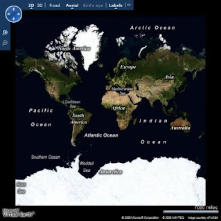
Using only this code, you can include a fully-functional Virtual Earth map control in your Web page. The control provides the ability for users to click and drag to move around the map, zoom by double-clicking or using a mouse scroll wheel, and change the view from a basic map, to arial view (based on satellite imagary) or even to birds-eye view (low level arial photography) where available. The map control is shown here:
On its own, the map control provides some interesting functionality, but for the Beanie Tracker application I want to use the control's API to visualize the data from the database. The key challenge here is to get the data from the database (which is on the server) to the Javascript used to render it on the map (which is in the browser). There are a number of ways to do this, including creating a Web Service or implementing a .aspx page that returns a text/xml document instead of HTML; but one of the most common is to implement a custom HTTP handler that returns the data as a GeoRSS feed, and consume that feed from the Javascript in the Web page. GeoRSS is an XML-based feed format for exchanging Geographic Markup Language (GML) elements across the Internet. Here's an example of a GeoRSS feed:

<?xml version="1.0" encoding="utf-8" ?>

<feed xmlns="http://www.w3.org/2005/Atom"
xmlns:georss="http://www.georss.org/georss"
xmlns:gml="http://www.opengis.net/gml">

<title>BeanieTracker</title>

<subtitle>Beanie Locations</subtitle>

<link href=http://www.graemesplace.com/beanietracker.htm/ />

<updated>10/11/2008 09:28:09</updated>

<author>

<name>Graeme Malcolm</name>

</author>

<entry>

<title>Beanie diving in the Red Sea</title>

<description><img src='Photo.aspx?PhotoID=1' height='100'/><p>4329.09 km from
home</p></description>

<georss:where>

<gml:Point xmlns="http://www.opengis.net/gml">

<gml:pos>27.8487 34.2865</gml:pos>

</gml:Point>

</georss:where>

</entry>

<entry>

<title>Beanie at Edinburgh Castle</title>

<description><img src='Photo.aspx?PhotoID=2' height='100'/><p>18.05 km from
home</p></description>

<georss:where>

<gml:Point xmlns="http://www.opengis.net/gml">

<gml:pos>55.9486 -3.2005</gml:pos>

</gml:Point>

</georss:where>

</entry>

</feed>

To get this feed to the browser, I created an HTTP handler that builds the XML for the feed, inserting the GML representations of the spatial data in the database; which are retrieved through some stored procedures in the database itself. Since there are two options that the user can use to retrieve a GeoRSS feed (one for photos of locations Beanie has visited, and one for a list of countries and a count of visits Beanie has made to them), I added some logic in the HTTP handler to look for a parameter, and create the appropriate feed with data from the corresponding stored procedure. The main sections of code (in VB .NET) from the handler are shown here:

Public Sub ProcessRequest(ByVal context As HttpContext) Implements
IHttpHandler.ProcessRequest

context.Response.ContentType = "text/xml"

Dim rssOutput As New System.Text.StringBuilder("<?xml version='1.0' encoding='utf-8'?>")

Try

'Build the GeoRSS feed

rssOutput.AppendLine("<feed xmlns='http://www.w3.org/2005/Atom'")

rssOutput.AppendLine("xmlns:georss='http://www.georss.org/georss'")

rssOutput.AppendLine("xmlns:gml='http://www.opengis.net/gml'>")

rssOutput.AppendLine("<title>BeanieTracker</title>")

rssOutput.AppendLine("<subtitle>Beanie Locations</subtitle>")

rssOutput.AppendLine("<link href='http://localhost/beanietracker/'/>")

rssOutput.AppendLine("<updated>" + System.DateTime.Now + "</updated>")

rssOutput.AppendLine("<author>")

rssOutput.AppendLine("<name>Graeme Malcolm</name>")

rssOutput.AppendLine("</author>")

Dim dataParam As String = context.Request.QueryString("data")

If Not dataParam Is Nothing Then

If dataParam = "locations" Then

GetPhotos(rssOutput)

ElseIf dataParam = "countries" Then

GetCountries(rssOutput)

Else

Throw New Exception("Invalid parameter")

End If

End If

'Close the <feed> document and send it as the response

rssOutput.Append("</feed>")

context.Response.Write(rssOutput.ToString())

Catch e As Exception

OutputError(e.ToString(), context)

End Try

End Sub


Private Sub GetPhotos(ByRef rssOutput As System.Text.StringBuilder)

Using sqlConn As New SqlConnection(connStr)

'Open a connection to the database

sqlConn.Open()

Dim spName As String

'Use the GetPhotosGML stored proc to get all stores by default

spName = "GetPhotosGML"

Using cmd As New SqlCommand()

cmd.Connection = sqlConn

cmd.CommandType = Data.CommandType.StoredProcedure

'Specify the stored procedure name as the command text

cmd.CommandText = spName

Using geomRdr As SqlDataReader = cmd.ExecuteReader()

'Read the DataReader to process each row

While (geomRdr.Read())

'Create an <entry> element for this row

rssOutput.AppendLine("<entry>")

rssOutput.AppendLine(String.Format("<title>{0}</title>", geomRdr.GetValue(1)))

rssOutput.AppendLine(String.Format("<description>&lt;img
src='Photo.aspx?PhotoID={0}' height='100'/&gt;&lt;p&gt;{1} km from
home&lt;/p&gt;</description>", _

geomRdr.GetValue(0), geomRdr.GetValue(3)))

'Add a <georss:where> element

rssOutput.AppendLine("<georss:where>")

Dim gml As String

'Get the geography instance GML from column 2

gml = geomRdr.GetValue(2).ToString()

'Append the gml: prefix to all the elements due to VE parsing behavior

gml = gml.Replace("<", "<gml:")

gml = gml.Replace("gml:/", "/gml:")

'Add the <gml:> elements to the output XML

rssOutput.AppendLine(gml)

'Close <georss:where> and <entry> elements

rssOutput.AppendLine("</georss:where>")

rssOutput.AppendLine("</entry>")

End While

End Using

End Using

End Using

End Sub


Private Sub GetCountries(ByRef rssOutput As System.Text.StringBuilder)

Using sqlConn As New SqlConnection(connStr)

'Open a connection to the database

sqlConn.Open()

Dim spName As String

'Use the GetPhotosGML stored proc to get all stores by default

spName = "GetCountriesGML"

Using cmd As New SqlCommand()

cmd.Connection = sqlConn

cmd.CommandType = Data.CommandType.StoredProcedure

'Specify the stored procedure name as the command text

cmd.CommandText = spName

Using geomRdr As SqlDataReader = cmd.ExecuteReader()

'Read the DataReader to process each row

While (geomRdr.Read())

'Create an <entry> element for this row

rssOutput.AppendLine("<entry>")

'Use columns 0 and 1 for the title and description

rssOutput.AppendLine(String.Format("<title>{0}</title>", geomRdr.GetValue(1)))

rssOutput.AppendLine(String.Format("<description>{0}</description>", _

geomRdr.GetValue(3)))

'Add a <georss:where> element

rssOutput.AppendLine("<georss:where>")

Dim gml As String

'Get the geography instance GML from column 2

gml = geomRdr.GetValue(2).ToString()

'Append the gml: prefix to all the elements due to VE parsing behavior

gml = gml.Replace("<", "<gml:")

gml = gml.Replace("gml:/", "/gml:")

'Add the <gml:> elements to the output XML

rssOutput.AppendLine(gml)

'Close <georss:where> and <entry> elements

rssOutput.AppendLine("</georss:where>")

rssOutput.AppendLine("</entry>")

End While

End Using

End Using

End Using

End Sub

The code merges the GML results from the stored procedures into an XML feed, which is built up using simple string concatenation. You could use an XmlDocument or XmlWriter for this (or you could even use SQL Server's native XML support to generate the complete XML in the stored procedures), but this approach makes it easier to see what's going on. Note that SQL Server includes a gml:http://www.opengis.net/gml namespace declaration in the query results. However, the Virtual Earth map contol appears to require that all namespaces be declared in the root element of the feed, so I had to add code to strip out the namespace in the query results.

Next I needed to register the HTTP handler so that any requests for URLs with the extension .georss are handled by the custom handler, and not treated as regular ASP.NET pages. There's nothing special about the extension .georss by the way, I just chose to use that for my handler. To register a custom handler, you need to edit the Web.Config of your ASP.NET application. The specific entry you need to create depends on whether you are using IIS 6 or IIS 7 - see this KB article for more information. The configuration I used is shown here:


<httpHandlers>

<!--Register the GeoRSSHandler for .georss requests -->

<add verb="*" path="*.georss" type="GeoRSSHandler" validate="false"/>

</httpHandlers>

Finally, I needed to create some client-side Javascript to retrieve the feed and import it into the Virtual Earth map control. Here are the functions to do this (one to retrieve the photo locations feed, and one to retrieve the countries feed):

function ShowBeanieLocations()
{
try
{
map.DeleteAllShapes();
// Import GeoRSS feed of location data, and call onBeanieLocationsLoad function
when the data is loaded
var veLayerSpec = new VEShapeSourceSpecification(VEDataType.GeoRSS,"./Beanie.georss?data=locations");
map.ImportShapeLayerData(veLayerSpec, onBeanieLocationsLoad, true);
}
catch(e)
{
document.getElementById("Info").innerHTML = e.Message;
}
}

function ShowCountries()
{
try
{
map.DeleteAllShapes();
// Import GeoRSS feed of country data, and call onCountriesLoad function when the data is loaded
var veLayerSpec = new VEShapeSourceSpecification(VEDataType.GeoRSS,"./Beanie.georss?data=countries");
map.ImportShapeLayerData(veLayerSpec, onCountriesLoad, true);
}
catch (e)
{
document.getElementById("Info").innerHTML = e.Message;
}
}

Both of these functions follow the same basic procedure:

  1. Clear all existing shapes from the map control
  2. Retrieve the feed by requesting a .georss file wth the appropriate parameter (note that the actual file name is unimportant, the custom handler handles all .georss requests)
  3. Import the feed into the map control as a shape layer by using the ImportShapeLayerData method

The ImportShapeLayerData method is asynchronous, so a callback function to be run when the impoprt has completed is specified. Here are the callback functions in the Beanie Tracker application:

function onBeanieLocationsLoad(feed)
{
// Count the shapes returned
var locationcount = feed.GetShapeCount();
document.getElementById("Info").innerHTML = 'Beanie has visited ' +
locationcount + ' places.';
}

function onCountriesLoad(feed)
{
/ / Count the shapes returned
var locationcount = feed.GetShapeCount();
for (i=0;i<locationcount;i++)
{
var s = feed.GetShapeByIndex(i);
s.SetLineColor(new VEColor(0, 0, 0, 0));
var numVisits = s.GetDescription();
s.SetDescription("Beanie has visited this country " + numVisits + " times.");
var transparency = (numVisits % 9) / 10;
s.SetFillColor(new VEColor(255, 50, 100, transparency));
s.SetCustomIcon("<img src='images/transparentIcon.png'>" + numVisits +
"</img>");
}
document.getElementById("Info").innerHTML = 'The darker the country, the more times Beanie has visited it.';
}

The callback function for the photo location data feed just counts the number of shapes (which will be rendered as push pins on the map by default since they are all points defined by a single lat/long pair) and displays the total. The callback for the countries data is a little more complicated - The elements returned are polygons, and so will be rendered as shapes of countries on the map; the code changes the transparency property of each shape to reflect the number of visits Beanie has made to the country, so that the more visits Beanie has made, the darker the country will appear. Note that by default a pushpin is displayed in the center of the shape, but I've used the SetCustomIcon method to specify that a transparent image should be used instead and included the number of visits as text, so that's what appears on the map.

The last step is to hook the methods that retrieve the feeds up to the buttons on the Web page:

<input id="Button1" type="button" value="Show Beanie Locations"
onclick="javascript:ShowBeanieLocations()" />

<input id="Button2" type="button" value="Count Locations by Country:"
onclick="javascript:ShowCountries()"/>

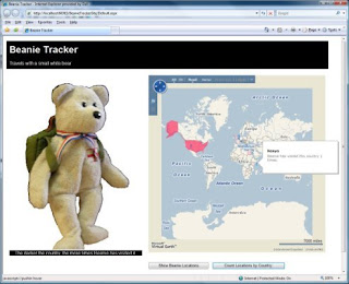
The resulting page is shown here:
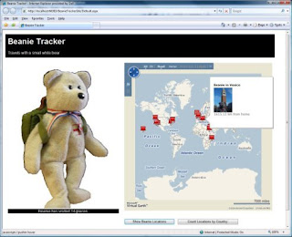


One minor issue I had to deal with is that the ImportShapeLayerData method of the Virtual Earth map control does not seem to handle MultiSurface GML elements in the GeoRSS feed. I had to change the spatial data for countries with multiple land masses to a single polygon in the database by adding a very thin line between each land mass. If anyone knows of a workaround for this, I'd love to hear about it!

Read More >>

Adventures in Spatial Data - Part 1

As part of my job at Content Master, I get to play around with some pretty cool new technologies. Unfortunately, I usually need to do this to a fairly tight deadline; and often at the end of a project I'm left feeling that I'd like to have a bit more time to dig a little deeper. Recently I completed some marketing collateral and Hands-On Labs on Spatial Data in SQL Server 2008 for the SQL Server Marketing team at Microsoft, and of all the technologies and products I've looked at recently, I find myself fascinated with this one. I've always been impressed with technology that's actually useful, so I've decided going to play around with spatial data to see what I can come up with. I should warn you, I'm not a GIS specialist, but I love that I can now incorporate geographical data into SQL Server databases - even with SQL Server Express Edition.

As a basic context for learning about this stuff, I've decided to create a simple Web-based application that combines spatial data in SQL Server 2008 with Virtual Earth. Specifically, it will track the travels of Beanie - a small white bear that we've had in our family for a number of years and who gets taken with us wherever we go (it's a long story!). Here's Beanie:

The Web application is available at http://www.graemesplace.com/beanietracker.htm, and I'll spend the next couple of blog articles dissecting it (and probably making changes to it as I go).

OK, so let's cover a few basics first. Spatial data support is new in SQL Server 2008, and takes the form of two new data types: geometry and geography. The first of these is designed to handle planar spatial data (i.e. points, lines and shapes on a flat surface), while the second is for geodetic spatial data (i.e. points, lines, and shapes on the surface of a spheroid - specifically the planet Earth). The data types ar quite similar to one another, and expose many of the same methods and properties - key differences between them include:
  • The geometry type uses arbitrary x and y coordinates to define spatial elements within a bounded flat area, while the geography type uses longitude and latitude coordinates to define spatial elements on the surface of the Earth.
  • The geometry type uses basic pythagorean mathematics to calculate distances between points, while the geography type accounts for the curvature of the Earth when calculating distances.
Since I want to integrate my data with Virtual Earth, it makes most sense to use the geography type for Beanie's travel data.

The first thing I need to do is to define the database objects for my application. For this aplication, I want to store the locations that Beanie has visited as a longitude/latitude point (along with information about the location and a photograph of Beanie there - just in case you thought I was making this up!)
So, here's the definition for the Photos table:
CREATE TABLE Photos
([PhotoID] int IDENTITY PRIMARY KEY,
[Description] nvarchar(200),
[Photo] varbinary(max),
[Location] geography)
GO


Note the Location column, which is defined as geography. All of the locations in this table will be simple long/lat points rather than lines or shapes, but the geography type will store any valid geography instance.

To insert a location, I can choose from a number of ways to parse the spatial data - depending on the format I have it in. For example, here's an INSERT statement that inserts a geography instance from a text-based decription of a point:
INSERT INTO Photos
([Description], Photo, Location)
VALUES
('Beanie in Las Vegas',
(SELECT * FROM OPENROWSET(BULK N'C:\BeanieTracker\3.JPG', SINGLE_BLOB) As [Photo]),
geography::STPointFromText('POINT (-115.1765 36.1132)', 4326))

Note the use of the STPointFromText static method. This parses the spatial text description, which must specify coordinates in longitude - latitude order. Note also the number 4326 specified as the Spatial Reference ID (SRID) - this is a code that determines the specific geodetic model that the coordinates are based on (in this case, 4326 indicates the WGS84 spheroid model used by GPS systems. There are a few different models, largely because it's difficult to be exact about what shape the Earth actually is! There's a useful article on this
here that might help if you're interested in learning more about ellipsoid models.)

Spatial data is commonly available in Geographic Markup Language (GML) format - an XML syntax for describing geospatial elements, and you can also insert data in this format as shown here:

INSERT INTO Photos
([Description], Photo, Location)
VALUES
('Beanie at Edinburgh Castle',
(SELECT * FROM OPENROWSET(BULK N'C:\BeanieTracker\2.JPG', SINGLE_BLOB) As [Photo]),
geography::GeomFromGml
('<Point xmlns="http://www.opengis.net/gml">
<pos>55.9486 -3.2005</pos>
</Point>'
, 4326))


Note the use of the GeomFromGml static method in this code, and also note that this time the coordinates are in latitude - longitude order. The reason for the inconsistancy stems from a late-breaking change in spatial data support in SQL Server 2008 (see
Isaac Kunen's blog article about this).

The next thing I need in the application is another table in which to store details about countries. The reason I need this is that I want to be able to find out how many locations Beanie has visited within each country, and show them visually on a map. I'll store the shapes of the countries as polygons - in terms of the database schema, I can use another geography column, since the data type can handle polygons and lines as well as points. here's the table definition:
CREATE TABLE Countries
(CountryID INT IDENTITY PRIMARY KEY,
CountryName nvarchar(255),
CountryShape geography)


To insert the polygon data, I can use the same basic approaches I used for the long/lat points in the Photos table. All I need to do is to describe the polygon as a sequence of points, as shown in this example:
INSERT INTO Countries
(CountryName, CountryShape)
VALUES
('France',
geography::STPolyFromText
('POLYGON
((
2.109375 51.01375465718818,
0.615234375 50.17689812200107,
-0.439453125 49.439556958940855,
-1.2744140625 49.837982453084834,
-2.1533203125 49.696061819115634,
-2.28515625 48.893615361480194,
-4.9658203125 48.83579746243093,
-4.5703125 47.635783590864854,
-3.1640625 47.487513008956554,
-1.6259765625 46.07323062540835,
-1.3623046875 44.809121700077355,
-1.845703125 43.32517767999296,
0.615234375 42.682435398386204,
3.0322265625 42.42345651793833,
4.2626953125 43.421008829947254,
6.2841796875 42.74701217318067,
7.6025390625 43.7393520791547,
6.943359375 44.37098696297173,
6.6357421875 45.182036837015886,
6.5478515625 46.49839225859763,
5.9765625 46.13417004624326,
6.328125 46.6795944656402,
7.119140625 47.57652571374621,
8.2177734375 48.951366470947725,
6.5478515625 49.32512199104001,
4.833984375 50.064191736659104,
4.21875 49.89463439573421,
4.1748046875 50.3734961443035,
2.98828125 50.62507306341437,
2.109375 51.01375465718818
))', 4326)
)

As before, I can also import the data in GML format:

INSERT INTO Countries
(CountryName, CountryShape)
VALUES
('Egypt',
geography::GeomFromGml
(
'<Polygon xmlns="http://www.opengis.net/gml">
<exterior>
<LinearRing>
<posList>
31.57853542647338 24.9609375
31.128199299111959 24.697265625
30.524413269923986 24.9609375
30.221101852485983 24.609375
29.152161283318915 24.9609375
21.94304553343818 24.9609375
21.983801417384697 34.1015625
23.140359987886114 35.6396484375
27.9361805667694 34.43115234375
29.535229562948469 34.892578125
31.278550858946531 34.21142578125
31.222197032103196 32.32177734375
1.597252561706661 31.1572265625
30.939924331023441 28.76220703125
31.57853542647338 24.9609375
</posList>
</LinearRing>
</exterior>
</Polygon>'
, 4326)
)


Again, note the difference in the ordering of the longitude and latitude coordinates between the two methods. Also note that you must describe the polygon as a sequence of coordinates that enclose the shape you want to store in a counter-clockwise direction. The reason for this requirement is to avoid ambiguity about the part of the Earth's surface you want to include in the shape and the rest of the Earth's surface. For example, look at the following picture:


Now, does this show a small red circle on a gray sphere, or does it show a large gray area that covers most of a red sphere? By using the convention of describing polygons by enclosing them in a counter-clockwise direction, you can be unambiguous about which shape you're describing. Additionally, if you try to define a shape that is larger than a hemisphere, the geography type will raise an exception - and this is often happens when you describe polygon in the wrong direction by mistake. See this article in Ed Katibah's blog for an interesting discussion about this.
OK, back to our database - and an interesting problem. Some countries consist of more than one landmass. In other words, they include multiple polygons. Fortunately, the geography data type can handle this scenario as shown in the following code, which creates a geography instance for the United States that includes the mainland US, Alaska, and Hawaii:
INSERTINTO Countries
(CountryName, CountryShape)
VALUES
('United States of America',
geography::STMPolyFromText
('MULTIPOLYGON(
((-123.07402588363084 37.767367310117017,
-121.94097917688177 36.490937923858858,
-120.37149732826121 34.045890710439785,
-117.16155430516534 32.715680633728539,
-115.13671875 32.54681317351514,
-110.390625 31.203404950917395,
-108.6328125 31.653381399664,
-106.47549795243778 31.733844355633792,
-103.7109375 29.075375179558346,
-101.56221503336745 29.807382670042525,
-100.89817721206964 29.366207091173063,
-99.501983817857962 27.530904416002304,
-97.505157798460743 25.866221792519891,
-97.149468867243158 25.943457571654395,
-97.176960378652467 27.675151290420871,
-93.894849576786243 29.732981419413576,
-90.506037559706073 29.06303206938912,
-89.12109375 30.353916372297035,
-86.1328125 30.27804437780013,
-85.2099609375 29.649868677972303,
-83.95751953125 29.99300228455108,
-81.780293310096368 24.5583430193,
-80.134852769446283 25.792769876534258,
-80.101951906484146 26.931995972872219,
-80.606873856214719 28.079387728938791,
-80.537540582081022 28.470839206510636,
-80.749057521104547 32.189103634193479,
-75.984925610664732 35.373785353022406,
-71.591597672350787 41.189858770922925,
-70.3056301459883 41.801225588436182,
-66.967327818020152 44.812878222881466,
-69.154285648166763 47.454989805995105,
-71.538670536472367 44.99637100669522,
-74.735724992604418 45.028448990132183,
-77.250621135570626 43.995140406452222,
-79.064274837925424 43.10662863009243,
-78.878439231461826 42.88544317671419,
-82.652583599187864 41.76926713330969,
-84.347939004022578 46.518294248124974,
-89.245498827623535 48.381706457487851,
-102.54842574981625 49.00235529594778,
-122.7588943299908 48.976728632317268,
-123.14601579176878 48.165524140067781,
-123.43134011415688 48.118720268780265,
-124.73518224557731 48.391678533676071,
-123.07402588363084 37.767367310117017)),
((-141.15234375 59.88893689676585,
-141.50390625 70.08056215839737,
-156.68701171875 71.43417616304582,
-168.3984375 68.84766505841037,
-164.8828125 66.99884379185184,
-169.1015625 65.58572002329472,
-164.70703125 63.704722429433225,
-169.1015625 60.23981116999892,
-162.59765625 58.17070248348609,
-171.5625 51.83577752045248,
-153.6328125 56.072035471800866,
-148.0078125 59.44507509904714,
-141.15234375 59.88893689676585)),
((-159.169921875 22.411028521558702,
-159.85107421875 22.380555501421533,
-160.400390625 21.80030805097259,
-158.26904296875 21.238182425982312,
-157.08251953125 20.80747157680652,
-156.741943359375 20.478481600090564,
-156.02783203125 20.262197124246533,
-156.2255859375 19.673625561844392,
-155.819091796875 18.781516724349703,
-154.632568359375 19.383704634148017,
-155.8740234375 20.848545148787234,
-157.8955078125 21.749295836732088,
-159.2138671875 22.27893059841188,
-159.169921875 22.411028521558702))
)', 4326)
)
Note the use of the STMPolyFromText method, which includes a text description of three polygons. Of course, you can also use GML for this, as shown in the following code to define two polygons for the United Kingdom of Great Britain and Northern Ireland:

INSERT INTO Countries
(CountryName, CountryShape)
VALUES
('United Kingdom',
geography::GeomFromGml
('<MultiSurface xmlns="http://www.opengis.net/gml">
<surfaceMembers>
<Polygon>
<exterior>
<LinearRing>
<posList>
58.813741715707813 -5.09765625
58.539594766640484 -6.6796875
57.704147234341931 -7.998046875
56.022948079627454 -6.767578125
55.379110448010472 -6.15234375
55.07836723201514 -5.361328125
54.162433968067809 -3.779296875
53.540307391500221 -3.251953125
53.44880683542759 -4.7021484375
52.696361078274485 -4.98779296875
52.749593726741139 -4.24072265625
52.308478623663355 -4.2626953125
51.944264879028765 -5.38330078125
51.440312757160115 -5.07568359375
51.508742458803319 -3.955078125
51.358061573190916 -3.5595703125
51.303145259199056 -3.1640625
51.206883394865621 -4.482421875
50.007739014636869 -5.99853515625
49.908787000867136 -5.0537109375
50.247204901392671 -4.24072265625
50.12057809796007 -3.69140625
50.471490851399558 -2.13134765625
50.583236614805884 -0.72509765625
50.861444110589233 1.12060546875
51.23440735163458 1.64794921875
51.577069537225668 1.0546875
52.1874047455997 1.77978515625
52.816043191549333 1.82373046875
53.054421865461023 0.615234375
52.948637884883205 0.3076171875
53.278353017531821 0.41748046875
54.610254981579146 -0.615234375
54.711928848406139 -1.12060546875
55.615589025267482 -1.51611328125
56.084297562061408 -2.63671875
55.986091533808384 -3.2080078125
56.022948079627454 -3.69140625
56.059769479106571 -3.22998046875
56.279960831728459 -2.548828125
56.389583525613055 -2.79052734375
57.112385007934009 -2.021484375
57.680660029772348 -1.73583984375
57.715885127745032 -3.8232421875
57.879816455278409 -3.7353515625
57.879816455278409 -3.955078125
58.562522728537338 -2.8125
58.813741715707813 -5.09765625
</posList>
</LinearRing>
</exterior>
</Polygon>
<Polygon>
<exterior>
<LinearRing>
<posList>
55.354135310210573 -7.31689453125
55.028022112992517 -7.4267578125
54.762670400254947 -7.646484375
54.711928848406139 -7.91015625
54.635697306063854 -7.93212890625
54.610254981579146 -7.7783203125
54.482804559582554 -8.173828125
54.1109429427243 -7.53662109375
54.188155481071512 -7.20703125
54.380557368630654 -7.03125
54.213861000644926 -6.85546875
54.188155481071512 -6.7236328125
54.046489113355761 -6.70166015625
54.033586335210849 -6.08642578125
54.393352223845881 -5.38330078125
54.800684867322332 -5.55908203125
54.863962939854758 -5.82275390625
55.216490131689788 -6.1083984375
55.241552035652518 -6.87744140625
55.354135310210573 -7.31689453125
</posList>
</LinearRing>
</exterior>
</Polygon>
</surfaceMembers>
</MultiSurface>
'
,4326)
)

After you've inserted your spatial data, you can query it in Transact-SQL. SQL Server Management Studio includes a pretty cool visualizer that lets you see your spatial data projected as a map:

You can retrieve spatial data in Binary, Text, or GML format as shown by the following queries and results:

SELECT [Description], [location]
FROM Photos

Results:
Beanie at Edinburgh Castle 0xE6100000010C287E8CB96BF94B40B4C876BE9F9A09C0
Beanie in Las Vegas 0xE6100000010C1FF46C567D0E42409EEFA7C64BCB5CC0


SELECT [Description], [location].ToString()
FROM Photos

Results:
Beanie at Edinburgh Castle POINT (-3.2005 55.9486)
Beanie in Las Vegas POINT (-115.1765 36.1132


SELECT [Description], [location].AsGml()
FROM Photos

Results:
Beanie at Edinburgh Castle<Point xmlns="http://www.opengis.net/gml"><pos>55.9486 -3.2005</pos></Point>
Beanie in Las Vegas<Point xmlns="http://www.opengis.net/gml"><pos>-115.1765 36.1132<pos></Point>

Of course, if the spatial support in SQL Server 2008 only enabled you to store and retrieve spatial objects, it would be of limited use. After all, you could just as easily store this data as text or XML. The real advantage of spatial data support is the ability to perform spatial operations on the data, and ask location-related questions such as "How many times has Beanie been in each country?" (or "What are the sales volumes for each sales region?" if you prefer) and "How far is this place from Beanie's home?"(or "Where's the nearest store to a customer's current location?"). Here are a couple of code samples that shpow how these kinds of query can be performed by using the instance methods of the geography data type.
-- Function to get the distance of any point from Beanie's home in Dunfermline, Scotland
CREATE FUNCTION GetDistanceFromHome (@location geography)
RETURNS float
AS
BEGIN
DECLARE @home geography;
SET @home = geography::STPointFromText('POINT(-3.408304452896118 56.06143472072096)', 4326)
DECLARE @dist float;
SET @dist = ROUND(@home.STDistance(@location)/1000, 2)
RETURN @dist
END
GO
-- Stored procedure to return all photos and their locations
CREATE PROCEDURE GetPhotosGML
AS
-- Return the location geography data as GML
SELECT [PhotoID], [Description], [Location].AsGml() As PhotoGML,
(SELECT dbo.GetDistanceFromHome(Location)) AS DistanceFromHome
FROM Photos
GO

EXEC GetPhotosGML

Results:
PhotoIDDescriptionPhotoGMLDistanceFromHome
2Beanie at Edinburgh Castle<Point xmlns="http://www.opengis.net/gml"><pos>55.9486 -3.2005</pos></Point>18.05
3Beanie in Las Vegas<Point xmlns="http://www.opengis.net/gml"><pos>36.1132 -115.1765</pos></Point>7940.86


SELECT c.CountryName, Count(p.PhotoID) Visits
FROMPhotos p, Countries c
WHERE p.Location.STIntersects(c.CountryShape) = 1
GROUP BY c.CountryName
Results:
CountryName Visits
Egypt 2
France 1


So, hopefully you've enjoyed this little exploration of spatial data in SQL Server 2008. The database code for the Beanie Tracker application is available from
http://cid-ddad9079cff45619.skydrive.live.com/self.aspx/Public/BeanieTracker.zip if you want to play with it yourself. You'll need SQL Server 2008 (you can get the Express Edition for free from http://www.microsoft.com/sqlserver/2008/en/us/express.aspx).
Next time, I'll describe the Web application and how to visualize your spatial data with the Virtual Earth map control.
Read More >>